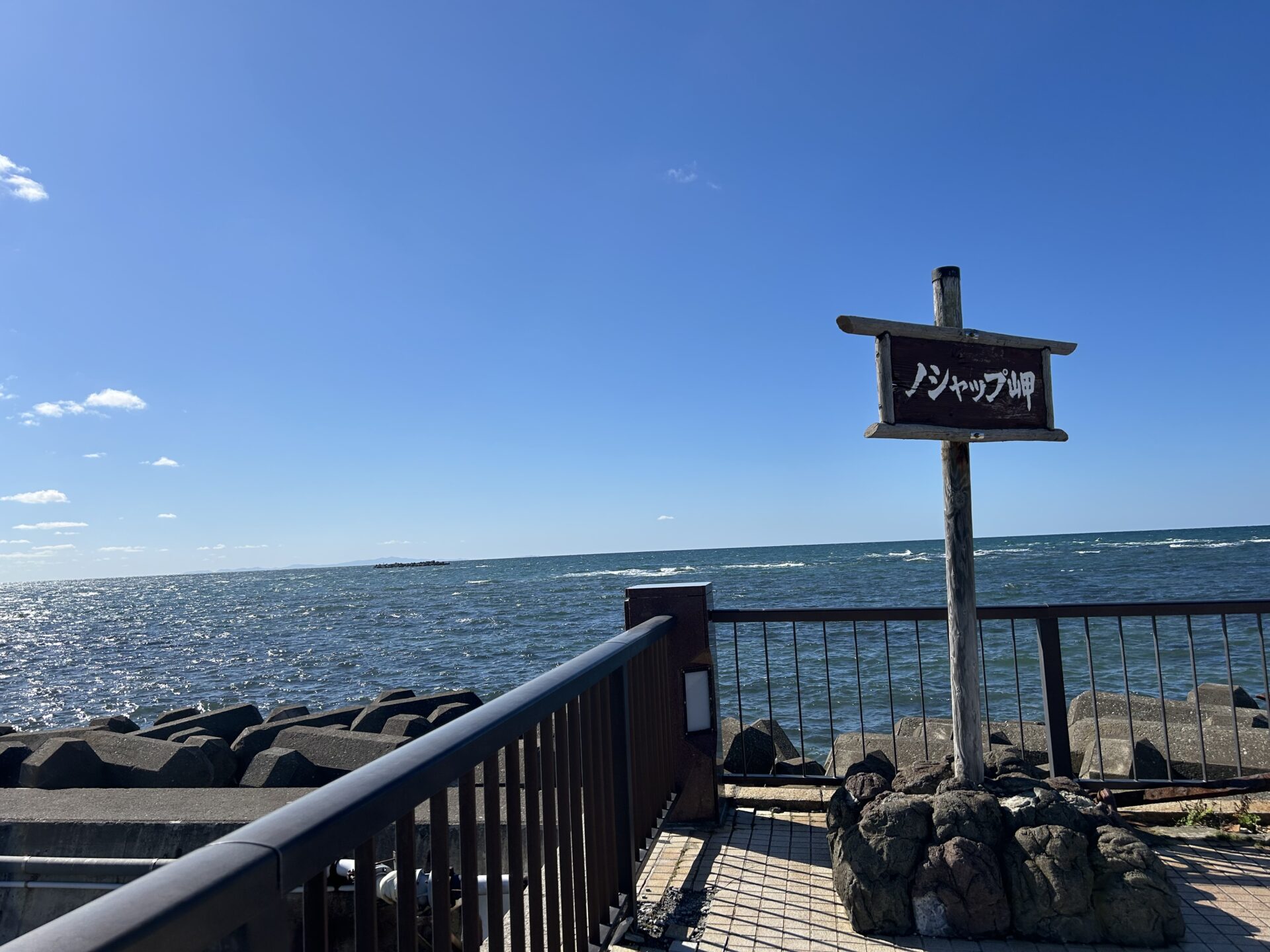

Hello. We’ve arrived at Cape Noshappu. This is the westernmost point of Wakkanai, where a beautiful view spreads out before us. To the east is Cape Soya, to the west is Rebun Island, to the southwest is Rishiri Island, and far to the north is Sakhalin. It is also known as a beautiful sunset spot, where the entire sea is bathed in orange, creating a stunning silhouette of Rishiri Fuji.
こんにちは。ノシャップ岬にやって来ました。ここは稚内の最西端です。東には宗谷岬、西には礼文島、南西には利尻島、そして遠く北にはサハリンが見えます。また、ここは美しい夕日スポットとしても知られており、利尻富士の見事なシルエットが浮かび上がります。
“Noshappu” has two meanings in Ainu language: “a cape that juts out like a chin” and “a place where waves break.” At the Eisan Park near the lighthouse, there’s a monument for Cape Noshappu, along with a dolphin monument based on a local tale of dolphins passing through the Soya Strait. In the surrounding area, you may spot marine mammals such as whales, dolphins, orcas, seals, sea lions, and Steller sea lions.
ノシャップという名前はアイヌ語で二つの意味があります。顎のように突き出た岬と、波が砕ける場所です。周辺では、クジラ、イルカ、シャチ、アザラシ、アシカ、そしてオットセイなどの海洋哺乳類を見ることができます。

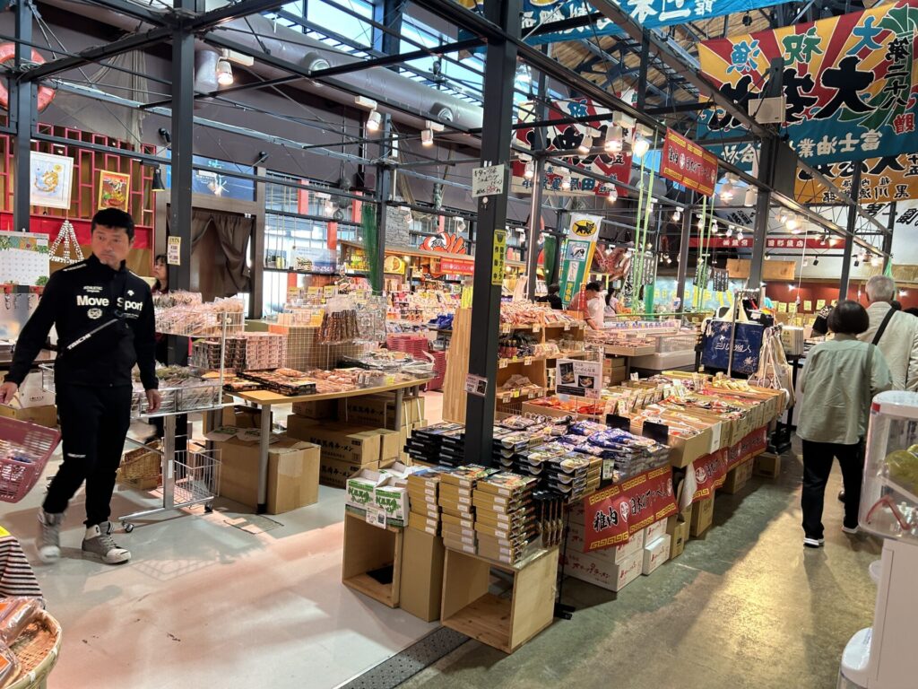
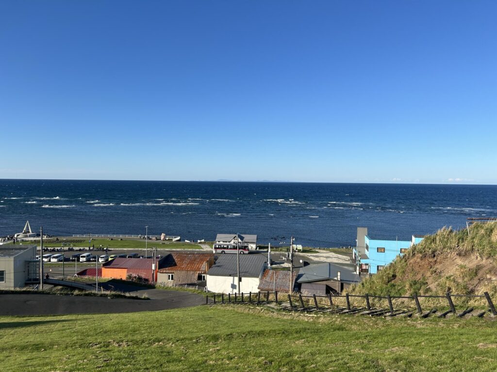
We came to Wakkanai Fukkou Market for a late lunch. Here, local seafood and Hokkaido souvenirs are sold everywhere. Unfortunately, the seafood bowl I was hoping to have was sold out, which is a shame. After filling my stomach, we head to our next destination, Cape Soya.
遅めのランチを食べに稚内副港市場にやって来ました。ここは地元の海産物や北海道のお土産がたくさんあります。残念ながら、楽しみにしていた海鮮丼は売り切れでした。お腹を満たした後、次の目的地である宗谷岬に向かいます。
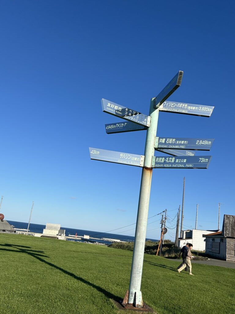
Finally, we’re at Cape Soya. Located in Wakkanai City, Cape Soya is at latitude 45 degrees north, the northernmost point of Japan’s mainland accessible to the public. Other places at the same latitude include Milan in Italy, Montreal in Canada, and Lyon in France. The monument at Cape Soya is designed to resemble the North Star, combining the letter “N,” which indicates north, with a circular pedestal symbolizing peace and cooperation. With its magnificent view, many tourists visit this commemorative spot, and there’s usually a line of people waiting to take photos in front of the monument.
ついに夢にまで見た、宗谷岬に到着しました。稚内市に位置する宗谷岬は、日本で一般人が行くことができる最北端、北緯45度にあります。同じ緯度にある都市には、イタリアのミラノ、カナダのモントリオール、フランスのリヨンがあります。宗谷岬の記念碑は北極星を模したデザインで、北を示す「N」の文字と平和と協力を象徴する円形の台座です。その壮大な景色を見にたくさんの観光客が訪れます。記念碑の前で写真を撮るため、たくさんの人が順番待ちしています。
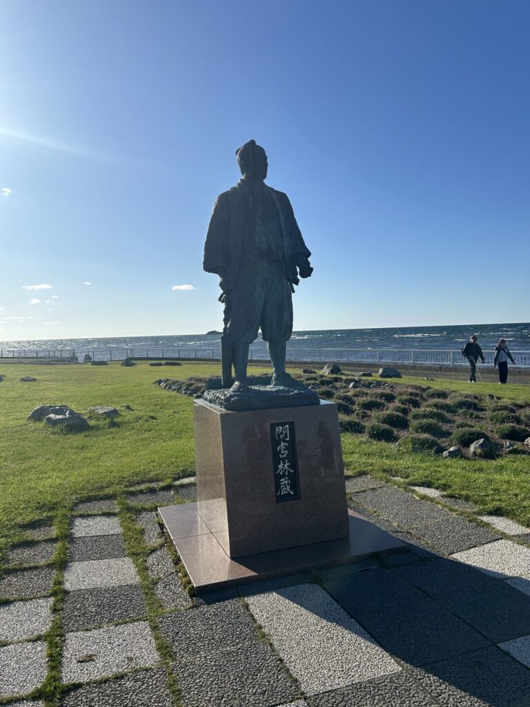

Nearby stands a statue of Rinzo Mamiya, an explorer known for his expeditions to Sakhalin during the Edo period. The average summer temperature here is about 20°C, and thanks to this cool climate, many alpine plants that can only be seen here thrive. The rich seafood is also one of the highlights. This is the northernmost cape in Japan, a dream destination for travelers.
近くには、江戸時代にサハリンへの探検で知られる探検家、間宮林蔵の像があります。ここの平均的な夏の気温は約20°C、涼しい気候のおかげで、ここでしか見ることができない高山植物がたくさんあります。
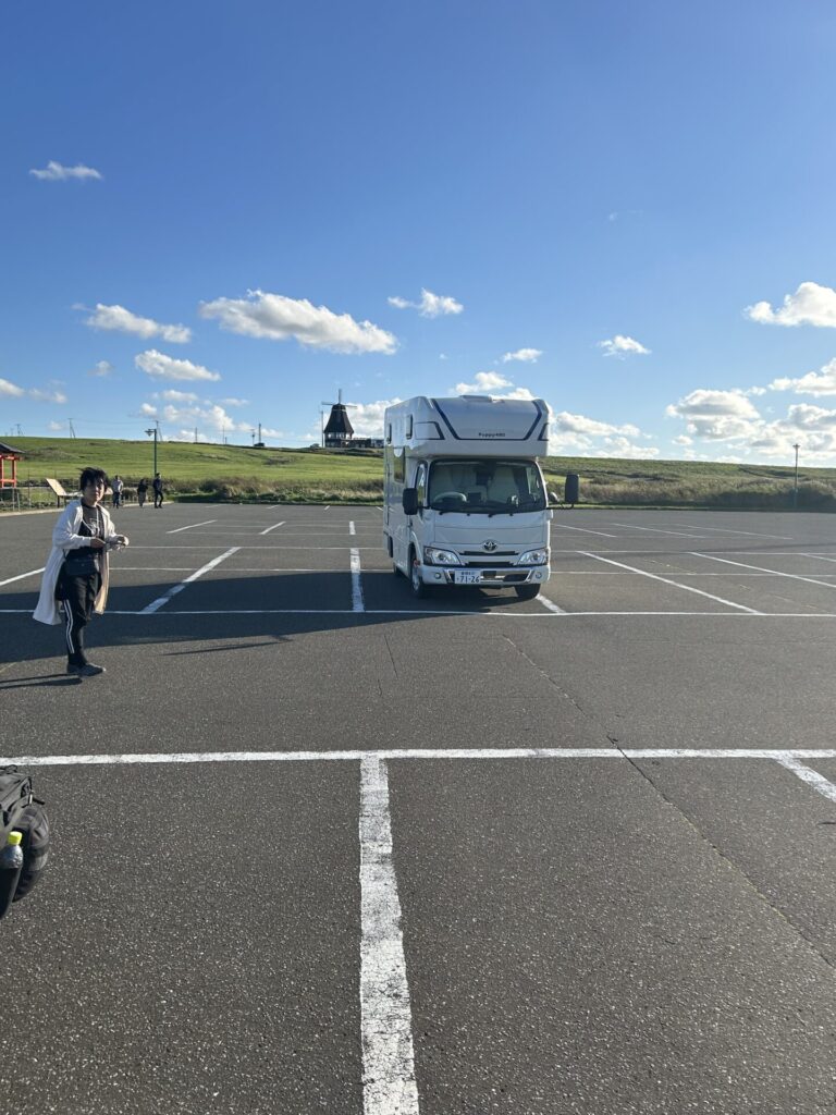
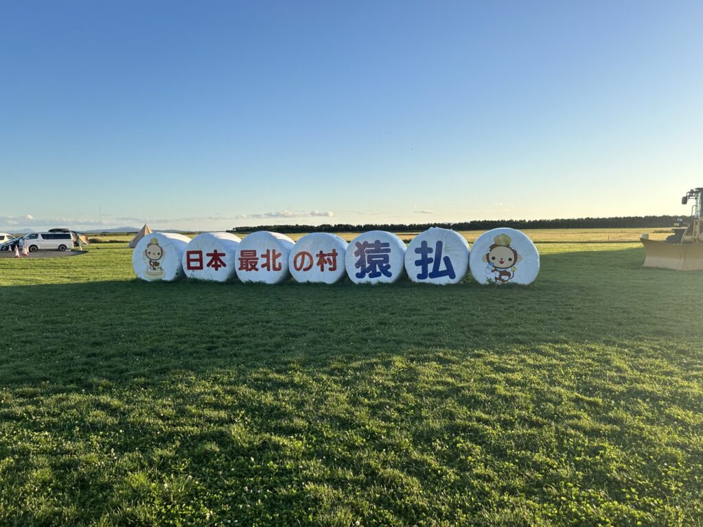
After leaving Cape Soya, we drive along Route 238, also known as Soya Road, heading to Sarufutsu Park Roadside Station. Route 238 is the northernmost national road in Japan, extending over 300 kilometers from Wakkanai City to Abashiri City, running almost the entire length along the coast of the Sea of Okhotsk.
宗谷岬を出発して238号線、通称宗谷道路を走り、さるふつ公園道の駅を目指します。238号線は日本最北の国道で、稚内市から網走市まで300キロメートル以上延びており、ほぼ全線がオホーツク海沿いを走っています。
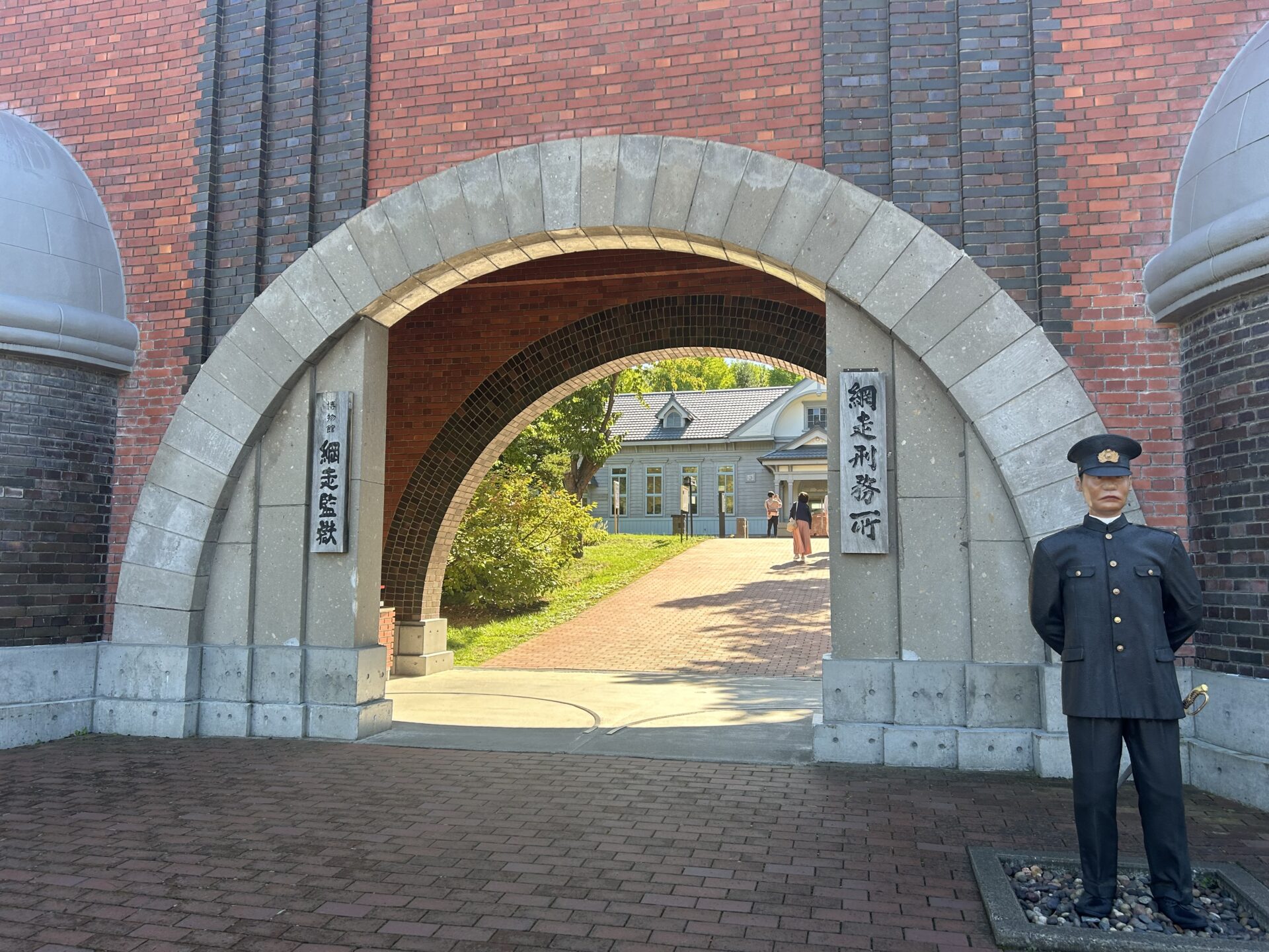
We will enjoy a hot spring at Sarufutsu Park Roadside Station. Although we could also enjoy a hot spring at Kamiyubetsu Onsen Roadside Station, where we’ll be staying overnight, we probably won’t arrive there within business hours, so we decided to change our plans and stop at Sarufutsu Park Rest Area instead. That’s it for today; next time, we’ll visit the Abashiri Prison Museum. See you!
さるふつ公園道の駅で温泉に入ります。今夜車中泊する予定だった、かみゆうべつ温泉道の駅で温泉に入るつもりでしたが、営業時間内に到着できそうにないため、予定を変更してさるふつ公園道の駅に立ち寄ることにしました。明日は網走監獄博物館を訪れます。
では、また!
コメント